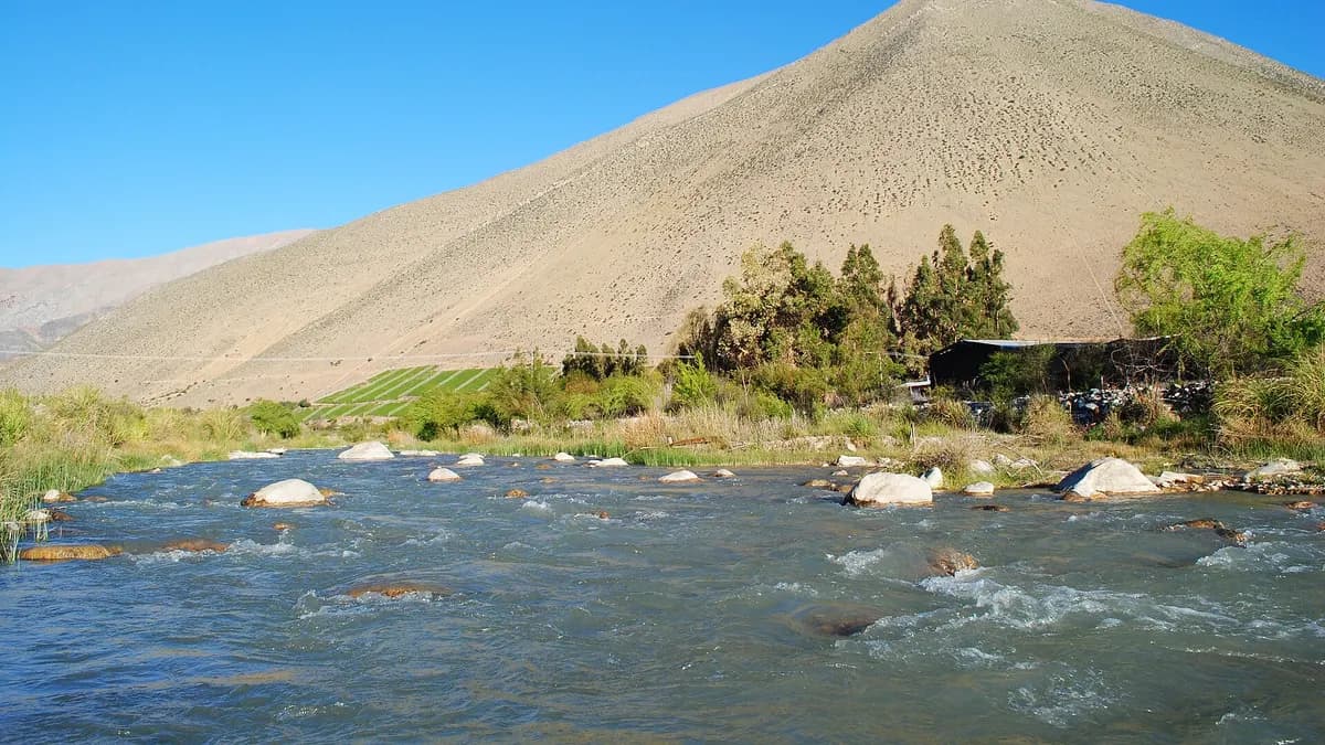
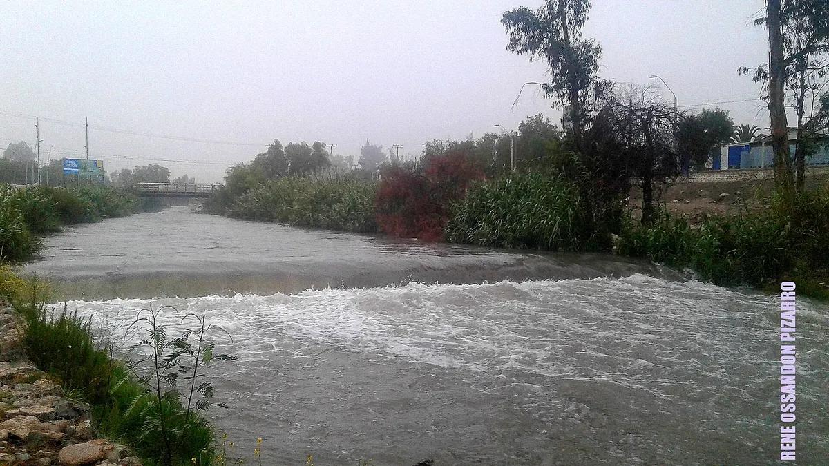
The Elqui River could approach 75 cubic metres per second around 13 November, above its 73 m³/s extreme-level threshold, according to a Google Flood Hub projection shared by Meteo La Serena and reported by [Mi Radio](https://www.miradiols.cl/2026/11/08/rio-elqui-podria-alcanzar-nivel-extremo-de-caudal-durante-los-proximos-dias-senapred-mantiene-alerta-preventiva-en-vicuna/). On Saturday 7, Senapred, Chile's disaster prevention service, updated the early preventive flood alert for Vicuña, Paihuano, Río Hurtado, Illapel and Salamanca in the Coquimbo Region, while in Atacama it extended its alert to the provinces of Copiapó and Huasco.
The cause is snowmelt: after a winter with heavy snow in the Andes, this weekend's high temperatures are speeding up melting and raising river flows. Reaching the extreme level does not necessarily mean flooding, the projection itself notes, and it can change with each update.
View the data as a table
| Projected Elqui River flow | 75 m³/s |
| Santa Juana reservoir (Huasco) | 100% |
| Preventive works on the Elqui | $200 M |
Where there are flood alerts in the Elqui Valley and the Norte Chico
In Coquimbo, the alert covers the Elqui, Limarí and Choapa valleys. The municipality of Monte Patria was also on yellow alert because of the rising Huatulame River: the gradual opening of the La Paloma reservoir gates undermined the ford linking El Tome Bajo, and the municipality and the roads authority were looking for alternative routes for Huanilla, Palos Quemados and El Tome Bajo, at risk of being cut off.
In Atacama, the early preventive alert in force since 26 September was extended to the provinces of Copiapó and Huasco. The water authority (DGA) warned that the Copiapó and Huasco rivers could rise from Saturday 7 and that the Santa Juana reservoir, in the Huasco valley, is at 100% capacity.
| Region | Municipalities or basins | Alert type | Reason |
|---|---|---|---|
| Coquimbo | Vicuña, Paihuano, Río Hurtado, Illapel and Salamanca | Early preventive alert (updated 7 Nov) | Snowmelt surges |
| Coquimbo | Monte Patria (Huatulame River) | Yellow alert | Rising river and La Paloma reservoir releases |
| Atacama | Copiapó and Huasco provinces (Alto del Carmen, Vallenar, Freirina and Huasco, among others) | Early preventive alert (since 26 Sep, extended 7 Nov) | Snowmelt surges; Santa Juana reservoir at 100% |
Source: Senapred, via Mi Radio, Epicentro Chile and Atacama Noticias, as of 8 November 2026. Alerts change: always check senapred.cl.
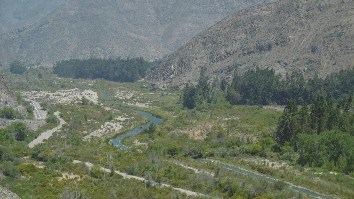
What will happen with the Elqui River in the coming days
The Elqui River water board had already forecast higher flows in the 2026-2027 melt season, with the strongest inflows between November and January. To reduce risks, it is carrying out preventive works worth about 200 million pesos on intakes, canals and distribution works on the Elqui, Turbio and Claro rivers.
This is not the first alert of the season: on 2 October Senapred had already declared an early preventive alert in Paihuano and Vicuña for flood risk. The same wet winter filled the region's reservoirs, as we covered in Coquimbo's full reservoirs.
- 26 SepAtacama alertEarly preventive flood alert.
- 2 OctPaihuano and VicuñaFirst preventive alert in the Elqui Valley.
- 6-7 NovYellow alert in Monte PatriaHuatulame River rises as La Paloma gates open.
- 7 NovSenapred extends alertsElqui, Limarí, Choapa, Copiapó and Huasco.
- 9 NovShowers and stormsLight coastal rain and possible thunderstorms in the foothills.
- ~13 NovProjected Elqui peakAbout 75 m³/s per Google Flood Hub (estimate).
Weather for Monday 9: from heat to showers
After a Sunday with highs of up to 33 °C inland in Coquimbo, a cut-off low could bring light, scattered rain on Monday 9, according to the forecast cited by Mi Radio: 1 to 3 millimetres on the Elqui and Limarí coast, showers with possible thunderstorms in the foothills and snow in the mountains, with gusts of up to 40 km/h. Stable weather would return on Tuesday 10.
| Day | Coast (Elqui and Limarí) | Foothills | Mountains |
|---|---|---|---|
| Sunday 8 | Hot; up to 33 °C inland | Hot | Active melting |
| Monday 9 | Light rain, 1-3 mm; gusts of 40 km/h | Showers with possible thunderstorms | Possible snow |
| Tuesday 10 | Stable, no rain | Stable | Stable |
Source: forecast cited by Mi Radio on 8 November 2026. For the coming summer, see also what to expect from El Niño in Chile.
What travellers heading to the Elqui Valley should know
- Do not camp or settle on riverbanks, riverbeds or ravines: meltwater flows rise sharply in the afternoon, after the hottest hours.
- Do not drive through fords with water: in Monte Patria the water has already undermined one ford and cut an alternative route.
- Take care on high-mountain trails: on Saturday 7, police rescued by helicopter a hiker injured by a falling rock in Panguesillo, Monte Patria, according to Mi Radio.
- Stargazing nights may be affected by cloud on Monday 9; confirm with the observatory before you go.
- Follow alerts on senapred.cl and local radio before heading to Pisco Elqui, Alcohuaz or inland Monte Patria.
The valley's attractions remain open. To plan your trip, see our guide to the Elqui Valley and its observatories, the pisco route and Elqui Valley tours.
Frequently asked questions
Is it safe to travel to the Elqui Valley in November 2026?
Yes, with caution. There is an early preventive alert, which is a monitoring status, not an evacuation. Avoid riverbanks and river crossings and check alerts before setting out.
Why do rivers rise without rain?
Because of snowmelt: heat melts the snow accumulated in the Andes during winter and that water flows down the rivers, with a lag of hours or days.
When would the Elqui River peak?
The Google Flood Hub projection cited by Meteo La Serena puts it around 13 November, at about 75 m³/s. It is an estimate and may change.