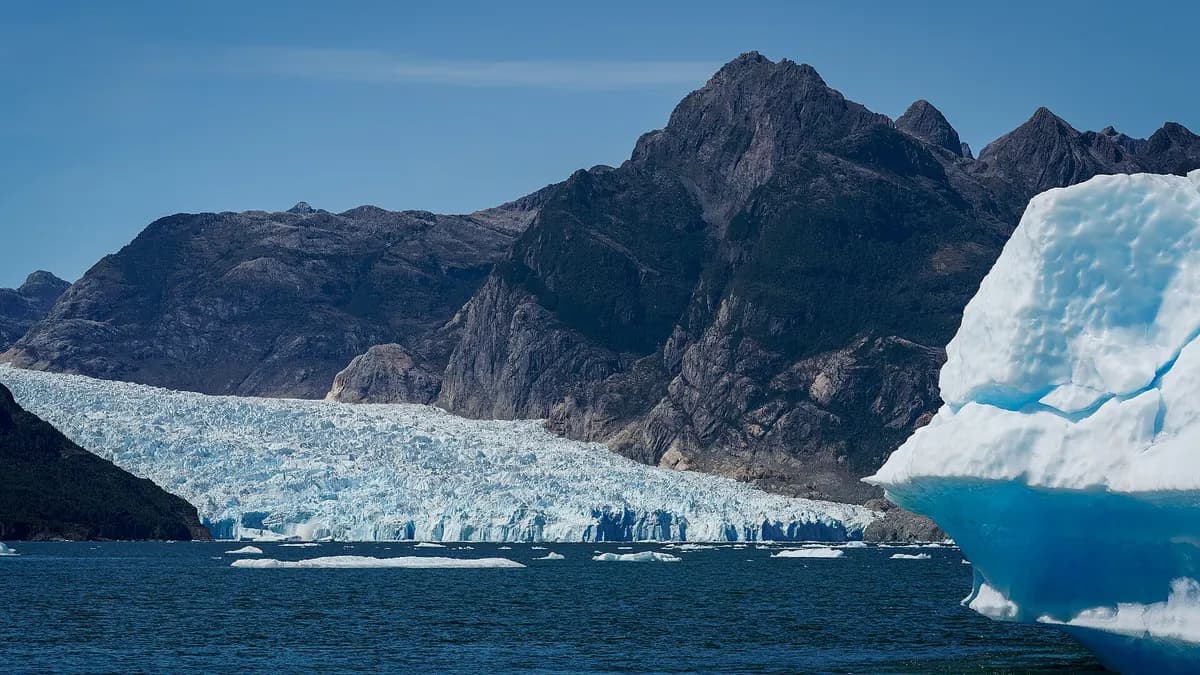
Laguna San Rafael, in Chile's Aysén Region, is where the San Rafael glacier, which flows down from the Northern Patagonian Ice Field, ends in the water with a front almost 4 km wide and about 60 meters high. It is visited by boat from Puerto Río Tranquilo or Puerto Chacabuco, or by light aircraft from Coyhaique. It is the heart of Laguna San Rafael National Park, created in 1959, covering 1,742,000 hectares and declared a UNESCO Biosphere Reserve in 1979, according to Conaf.
It is the third-largest national park in Chile, as we show in the largest national parks, and the San Rafael glacier, at 711 km², is the fourth-largest glacier in the country according to the General Water Directorate (DGA), as detailed in the largest glaciers in Chile. In 2025 the park received 8,348 visits, according to Conaf's official visitor spreadsheet.
Laguna San Rafael in figures
| Fact | Laguna San Rafael |
|---|---|
| Location | Aysén Region: municipalities of Aysén, Río Ibáñez, Chile Chico, Cochrane and Tortel |
| Park area | 1,742,000 ha, of which about 400,000 belong to the Northern Patagonian Ice Field |
| Created | June 17, 1959 (Supreme Decree 475) |
| UNESCO | Biosphere Reserve since 1979 |
| San Rafael glacier | Front almost 4 km wide and about 60 m high |
| Highest peak | Mount San Valentín, 4,058 m, the highest in the southern Andes |
| Visits in 2025 | 8,348 |
Sources: Conaf, Laguna San Rafael National Park fact sheet, and the Visitación Áreas Protegidas 2025 spreadsheet (corrected on February 28, 2026).
How to get to Laguna San Rafael
| Route | What it involves | Best for |
|---|---|---|
| From Puerto Río Tranquilo | By land through the Exploradores river valley to Bahía Exploradores (Puerto Grosse), then by boat to the lagoon. Route opened in 2010 | Travelers on the Carretera Austral and Lake General Carrera |
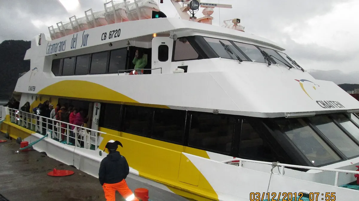
| From Puerto Chacabuco | By boat or catamaran through the channels, crossing the Témpanos river to the glacier front | Travelers starting from Coyhaique or Puerto Aysén |
| By light aircraft from Coyhaique | Flight over the Northern Patagonian Ice Field and landing in the park | Travelers short on time |
Source: Conaf. By road, Puerto Río Tranquilo is about 223 km south of Coyhaique on the Carretera Austral; route details are in our guide to the Carretera Austral road trip.
Tours to Laguna San Rafael: reference price
Most visitors arrive on a full-day tour. As a reference, the operator Nómade Experience lists in the tour catalog of the Aysén tourism portal a full day to Laguna San Rafael from Puerto Río Tranquilo at CLP 170,000 per person, plus CLP 20,000 for the optional 90 km road transfer to Puerto Exploradores. The document does not state which year the prices apply to. Departures from Puerto Chacabuco are usually by catamaran, also full-day; their fares vary by operator and season.
| Tour | Reference price | Source |
|---|---|---|
| Full day from Puerto Río Tranquilo (via Exploradores) | CLP 170,000 per person | Nómade Experience catalog, undated |
| Transfer Río Tranquilo-Puerto Exploradores (90 km) | CLP 20,000 per person | Same catalog |
| Park entrance | Listed on Pases Parques | Conaf |
Prices checked on October 27, 2026. Confirm the price, what is included and the bad-weather policy with the operator before paying: departures are canceled if the weather does not allow sailing.
Do you run a tour, boat service or lodging in Aysén? Reach the travelers planning the Carretera Austral in four languages.
See advertising options
Trails in Laguna San Rafael National Park
| Trail | Length | Duration | Difficulty |
|---|---|---|---|
| Mirador Glaciar | 500 m | 40 min | Easy |
| Isaías Colivoro | 600 m | 30 min | Easy |
| Glaciar | 1.6 km | 2 h | Moderate |
| San Valentín | 2.5 km | 4 h | Moderate |
Source: Conaf. The Glaciar trail closes between May and August, and trails may close in bad weather. Conaf warns that it is no longer possible to walk on the Exploradores glacier for safety reasons.
When to visit Laguna San Rafael
The high season runs from December to March. In 2025, January (1,959 visits) and February (2,063) accounted for almost half of the year's visitors, while fewer than 300 people came in total between May and August, according to Conaf's spreadsheet. In spring and autumn there are fewer people, but more departures canceled due to wind and rain.
| Month of 2025 | Visits | Month of 2025 | Visits |
|---|---|---|---|
| January | 1,959 | July | 30 |
| February | 2,063 | August | 67 |
| March | 1,385 | September | 321 |
| April | 690 | October | 322 |
| May | 149 | November | 622 |
| June | 29 | December | 711 |
Source: Conaf, Visitación Áreas Protegidas 2025. If you are planning a longer trip through Aysén, combine the lagoon with the Marble Caves, Lake General Carrera and things to do in Coyhaique.
What to bring to Laguna San Rafael
- Waterproof and warm clothing: on the boat and in front of the glacier the wind is cold even in summer.
- Sunscreen and sunglasses: the glare from the ice and water is intense.
- Seasickness tablets: sailing through the channels or the gulf can get rough.
- Cash: small towns in Aysén do not always have ATMs or phone signal.
Frequently asked questions
How do you get to Laguna San Rafael?
By boat from Puerto Río Tranquilo (via Bahía Exploradores) or from Puerto Chacabuco, or by light aircraft from Coyhaique.
How much does a Laguna San Rafael tour cost?
As a reference, a full day from Puerto Río Tranquilo is listed at CLP 170,000 per person, plus CLP 20,000 for the transfer. Confirm current prices with each operator.
What is the best time to visit Laguna San Rafael?
Between December and March, when there are more departures and better weather. The Glaciar trail closes from May to August.