Lake Ranco, in the Los Ríos Region, is Chile's fourth-largest lake, covering 424.6 km² according to the lake inventory of the General Directorate of Water (DGA), and lies about 120 kilometers from Valdivia, roughly two hours by car. It is surrounded by towns such as Futrono, Llifén and Lago Ranco, has islands inhabited by Mapuche-Huilliche communities and a road that circles it completely, according to the official Chile.travel page.
*Updated October 29, 2026.* Distances and services can change with the season: confirm them before setting out, especially if you are heading to Lake Maihue or along gravel roads.
Lake Ranco key facts
| Item | Value | Source |
|---|---|---|
| Surface area | 424.6 km² | DGA, lake inventory (Lakes layer in SIMBIO) |
| Rank among Chile's lakes | 4th, after General Carrera, Llanquihue and O'Higgins | DGA |
| Region | Los Ríos | Chile.travel |
| Main access points | Futrono and La Unión | Chile.travel |
| Nearest airfield | Pichoy (Valdivia), 120 km away | Chile.travel |
| Neighboring lake | Maihue (45.7 km²), to the southeast | DGA and Chile.travel |
Sources: the DGA lake inventory published in the Ministry of the Environment's SIMBIO system, and Chile.travel (page updated November 24, 2025). Chile.travel gives it about 442 km² and ranks it third in the country; we use the DGA figure, which measures every lake with the same method. The full ranking is in Chile's largest lakes.
Things to do at Lake Ranco
The lake is a summer destination for swimming, boating and fishing, but it also offers Mapuche-Huilliche culture, hot springs and native forest. These are the must-sees, with the source for each fact:
| Place or activity | What it is | Practical detail | Source |
|---|---|---|---|
| Huapi Island | An island in the lake home to a Mapuche-Huilliche community | Indigenous tourism | Chile.travel |
| Llifén | Lakeside area in the municipality of Futrono | Hot springs and forest outings | Chile.travel |
| Futangue Park | Native forest park | 21 km from the town of Lago Ranco | Chile.travel and BioBioChile |
| Nilahue falls | Waterfall more than 40 meters high | 35 km from Futrono, with a campsite | BioBioChile (2014) |
| Lake Maihue | Lake to the southeast of Ranco | Trout and salmon fishing in its streams | Chile.travel |
| Lakeshore road | Road that circles the whole lake | Scenic drive around the lake | Chile.travel |
Sources: Chile.travel and BioBioChile. The Nilahue falls data are from 2014; other sources describe a two-tier fall, so the height may vary depending on the viewpoint.
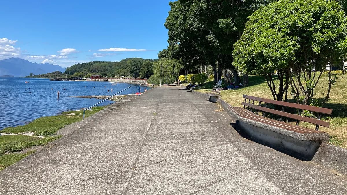
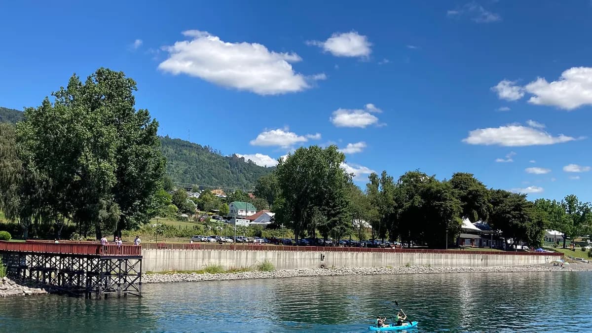
- Beaches and waterfront: the town of Lago Ranco has a waterfront promenade with a pier and beach access, where kayaks and boats set out.
- Boating and adventure: Chile.travel highlights nautical and adventure tourism experiences on the lake.
- Indigenous tourism: on Huapi Island you can learn about Mapuche-Huilliche culture; ask in Futrono or Lago Ranco how to cross and whom to arrange the visit with.
- Hot springs and forest: Llifén combines hot springs with forest outings and is the gateway to Lake Maihue.
Do you have cabins, a campsite or tours at Lake Ranco? Reach travelers planning southern Chile, in four languages.
See advertising optionsHow to get to Lake Ranco
The whole road from Valdivia or Osorno to Futrono is paved. From Santiago, the usual option is to fly to Valdivia and continue by bus; there are also direct buses to Futrono, according to Interpatagonia.
| From | To | Distance | Time or detail |
|---|---|---|---|
| Valdivia (via Route 5 South and the Futrono turnoff) | Lago Ranco | 120 km | About 2 hours |
| Pichoy airfield (Valdivia) | Lago Ranco | 120 km | About 2 hours |
| Valdivia (Route 207 to Paillaco, Route 5 and the Reumén junction) | Futrono | 102 km | Fully paved |
| Osorno (Route 5 to Río Bueno and then east) | Futrono | 80 km | Fully paved |
| Lago Ranco | Lake Maihue | About 40 km | Around 1 more hour |
Sources: Chile.travel for the trips to Lago Ranco and Maihue, and Interpatagonia for the routes to Futrono. Toward Maihue, depending on the season, you may need a 4x4 vehicle.
Lake Ranco weather month by month
We found no official climate normals published for a station on the lakeshore. The closest reference is the Osorno Cañal Bajo station of the Chilean Meteorological Directorate, with the 1980-2015 normals published by the Ministry of the Environment. They tell you what to expect in each season, not a forecast.
| Month | Average high (°C) | Average low (°C) | Rainfall (mm) |
|---|---|---|---|
| January | 22.9 | 8.9 | 45.5 |
| February | 22.8 | 8.4 | 45.0 |
| March | 20.3 | 7.3 | 61.7 |
| April | 16.4 | 5.8 | 113.6 |
| May | 13.3 | 5.2 | 176.0 |
| June | 11.0 | 3.9 | 198.4 |
| July | 10.7 | 3.4 | 161.4 |
| August | 12.0 | 3.7 | 156.4 |
| September | 14.1 | 4.1 | 96.1 |
| October | 16.2 | 5.4 | 79.1 |
| November | 18.3 | 6.7 | 57.9 |
| December | 21.0 | 8.2 | 54.3 |
| Year | 16.6 | 5.9 | 1,245.5 |
Source: Ministry of the Environment, *Climate normals, Los Ríos and Los Lagos regions* (2016), with Chilean Meteorological Directorate data for Osorno, 1980-2015. The Meteorological Directorate also records an average of 38 frost days a year in Osorno, concentrated in winter.
When to go
- January and February: the warmest months (average highs near 23 °C in Osorno) and the least rainy. It is beach season and the busiest time: Chile.travel recommends booking accommodation in advance.
- March, November and December: good months to travel with fewer crowds; afternoons are still mild.
- May to August: the rainiest (June exceeds 190 mm in the Osorno reference) and coldest period. The landscape is green, but some tourist services operate only in summer.
Lake Ranco compared with other southern lakes
| Lake | Surface area (km²) | Region |
|---|---|---|
| General Carrera (Chilean part) | 951.2 | Aysén |
| Llanquihue | 864.1 | Los Lagos |
| O'Higgins (Chilean part) | 499.2 | Aysén |
| Ranco | 424.6 | Los Ríos |
| Rupanco | 230.2 | Los Lagos |
| Villarrica | 175.0 | La Araucanía |
| Maihue | 45.7 | Los Ríos |
Source: DGA lake inventory in SIMBIO, retrieved October 29, 2026. Ranco is the largest lake in the Los Ríos Region and the fourth-largest in the country.
Travel tips
- Combine destinations: from the lake you can continue to Valdivia, the regional capital; see things to do in Valdivia.
- More native forest to the north: the Huilo Huilo Biological Reserve is in the same region and adds hot springs, waterfalls and trails.
- Respect local rules: Chile.travel notes that Ranco and Maihue are fragile ecosystems; follow the signs and take your garbage back with you.
- Check the road to Maihue: some stretches are gravel and, depending on the time of year, a 4x4 is advisable.
Frequently asked questions
Where is Lake Ranco?
In the Los Ríos Region, about 120 km from Valdivia. Its main access points are Futrono and La Unión.
How big is Lake Ranco?
It covers 424.6 km² according to the DGA, making it Chile's fourth-largest lake.
What is the weather like at Lake Ranco?
Temperate and rainy. In the Osorno reference, January has average highs of 22.9 °C and 45.5 mm of rain, and June has highs of 11 °C and almost 200 mm.
What is on Huapi Island?
It is an island in the lake inhabited by a Mapuche-Huilliche community, which offers indigenous tourism, according to Chile.travel.
Can you get there by bus?
Yes. There are intercity buses from Valdivia and Osorno, as well as direct services to Futrono from other cities.