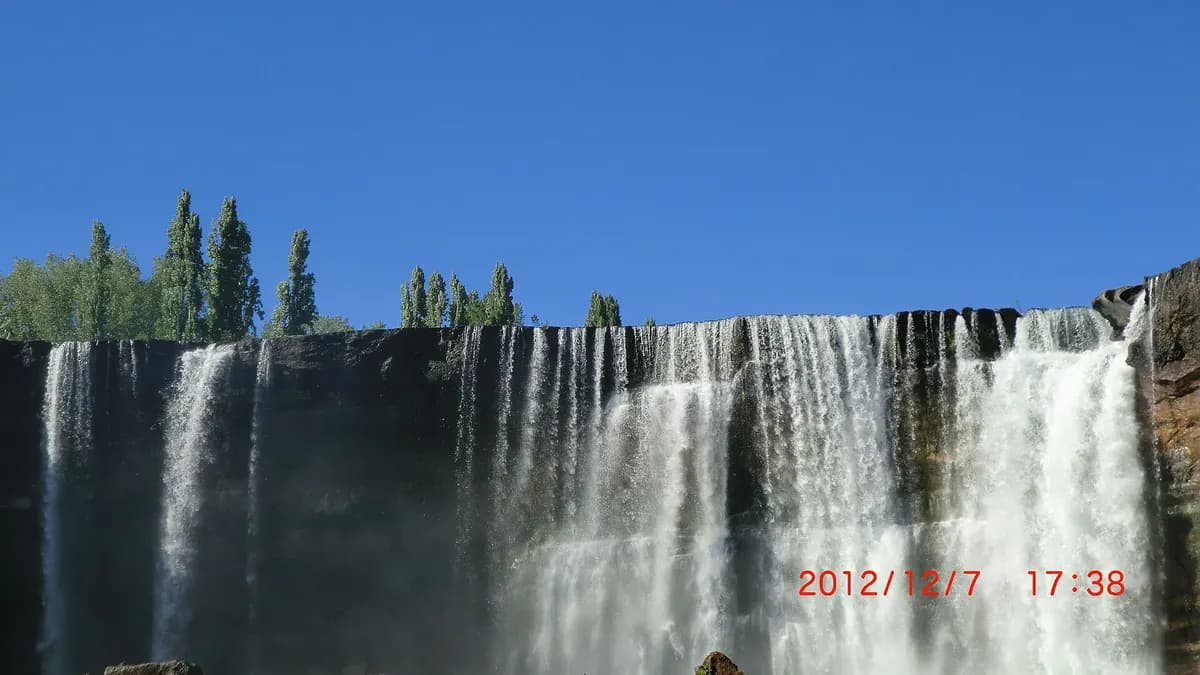
Saltos del Laja (Laja Falls) are four waterfalls on the Laja River, between 20 and 35 metres high, next to Route 5 South in Chile's Biobío Region, about 25 kilometres from Los Ángeles and 480 kilometres from Santiago. They are one of the best-known stops on the highway: you can see them from the road, access to the viewpoints is free and there are campsites, cabins, hotels and boat trips around them.
They formed about 13,000 years ago, when large eruptions of the Antuco volcano covered the valley with lava that cooled into a thick layer of basalt. The Laja River, which rises in the lake of the same name at about 1,400 metres, gradually wore down that rock until it dropped over a geological fault, according to the explanation reported by Meteored from the Los Ángeles municipality's tourist guide.
Laja Falls at a glance
| Item | Details |
|---|---|
| Location | Route 5 South, between Los Ángeles and Chillán, Biobío Region (municipalities of Los Ángeles and Cabrero) |
| Distances | 25 km from Los Ángeles, about 100 km from Concepción and 480 km from Santiago |
| Waterfalls | Four, from 20 to 35 metres |
| Entry | Free to the viewpoints and the waterfall area |
| Area hours | 9:00 to 21:00, daily (indicative) |
| Boat trip | CLP 5,000 adults and CLP 4,000 children, 11:00 to 19:00 (indicative, January 2026) |
Sources: Meteored (June 14, 2026), with data from the Los Ángeles municipality, and En Cancha (January 12, 2026). Hours and prices of private services may change; confirm them on arrival.
The four waterfalls of the Laja River
| Waterfall | Approximate height | Where |
|---|---|---|
| Main fall | 35 m | Visible from the highway, with viewpoints and a bridge |
| Second fall | 26 m | Next to the main one |
| Salto Chico | 25 m | 1 km away, on the road to Paraguay |
| Fourth fall | 20 m | Behind Salto Chico |
Source: En Cancha, January 2026. Heights vary by source and water flow; some guides give larger drops for the main fall.
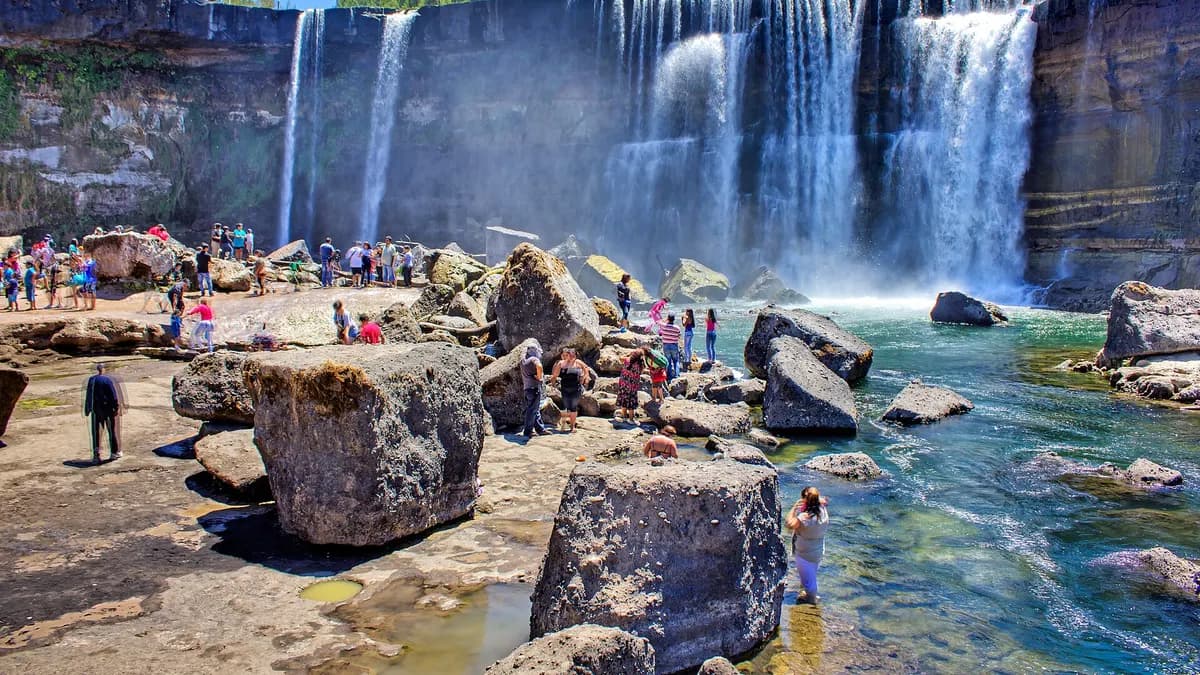
How to get to Laja Falls
- By car from Los Ángeles: take Route 5 north to the Route Q-119 exit; it takes about 30 minutes.
- By car from Santiago: Route 5 South, about 480 km; the exit is signposted Salto del Laja, near kilometre 480.
- By bus: from the Los Ángeles terminal, buses to Chillán or Concepción stop on Route 5 opposite the falls; walk from there to the entrance. From Santiago there are buses to Los Ángeles from the Sur and Alameda terminals.
- From Concepción or Chillán: combine the trip with our guides on what to do in Concepción and what to do in Chillán.
Do you have cabins, a campsite or a hotel near Saltos del Laja? Reach travellers driving Route 5.
See advertising optionsWhat to do at Laja Falls
- Viewpoints and bridge: the basic, free route to see the main fall from above.
- Walk down to the rocks: in the dry season you can reach the base on trails, with sturdy shoes and care on wet rock.
- Boat trip: on the river, in front of the waterfalls.
- Trekking in Parque La Cantera: trails among ferns, arrayán, nalca, peumo and espino trees.
- Adventure: zip-lining, horse riding and a Tibetan bridge, with local operators.
- Picnics and crafts: there are picnic areas, restaurants and craft stalls by the entrance.
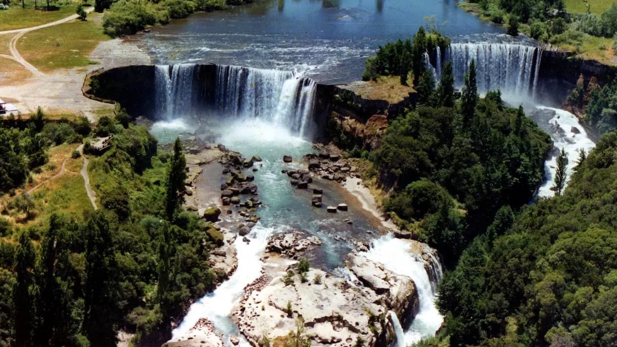
When to go: water flow by season
The flow changes a lot during the year. After the winter rains and in spring, the falls carry more water: in July 2026, after a weather front, police restricted access because of the risk of flooding, according to Meganoticias. In summer the water drops, because the river is also used for irrigation and power generation, but it is when you can walk on the rocks and more services are open.
| Season | Flow | Advantage | Watch out for |
|---|---|---|---|
| Winter (June to August) | High | Most powerful falls | Closures due to floods and rain |
| Spring (September to November) | Medium to high | Good flow and fewer people | Changeable days |
| Summer (December to February) | Low to medium | You can walk down to the rocks; more services | Crowds at weekends |
| Autumn (March to May) | Variable | Forest colours | Reduced service hours |
Where to stay in the area
Next to the falls there are campsites, cabins and hotels, many with river views. The other option is to stay in Los Ángeles, half an hour away, which has more choice and services. If you continue south, the lakes and volcanoes region begins in Araucanía: see what to do in Temuco and our route of hot springs in Chile.
Frequently asked questions
How much does it cost to visit Laja Falls?
Access to the viewpoints and the waterfall area is free. Services such as boat trips or private parking are paid separately.
Where are Laja Falls?
In Chile's Biobío Region, next to Route 5 South, about 25 km north of Los Ángeles.
How high is the Salto del Laja?
The main fall is about 35 metres high; the other three are between 20 and 26 metres.