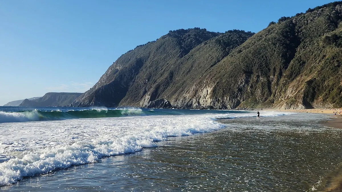
Cobquecura is a coastal town and the seat of the municipality of the same name, in the Itata province of Chile's Ñuble Region, with 52 km of beaches, a sea lion colony 250 metres offshore, the Iglesia de Piedra (Stone Church) and a historic centre declared a Typical Zone. Its name comes from Mapudungun and means "stone of bread", according to Wikipedia.
This guide covers things to do in Cobquecura, the weather, when to go and how to get there, with data checked on 9 November 2026. Opening hours and prices change: check them before you travel.
View the data as a table
| km of beaches in the municipality | 52 |
| metres between the beach and the sea lion colony | 250 |
| houses in the Typical Zone | 22 |
| inhabitants of the municipality (2017 census) | 5,012 |
Cobquecura's Stone Church and sea lion colony
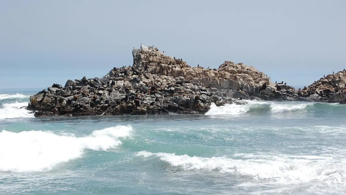
The town's two icons make up the Islote Lobería and Iglesia de Piedra Nature Sanctuary, declared on 1 September 1992 by Supreme Decree 544 (Wikipedia). The colony consists of three rocks about a hundred metres each, 250 metres from the beach, where South American sea lions live and breed (Wikipedia). At low tide a path forms towards the islet, but crossing it is forbidden and fined: in 2014 tourists walking onto it caused a stampede in which pups died.
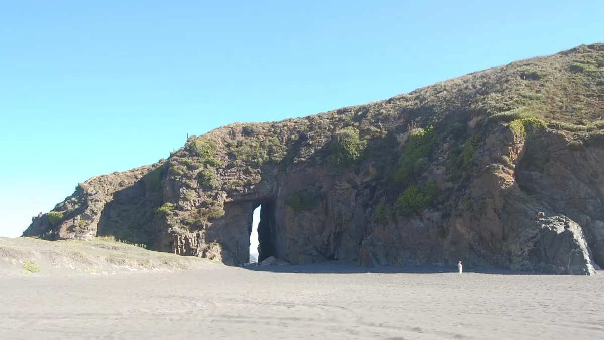
The Iglesia de Piedra, at the northern end of the beach near Pilicura and Buchupureo, is a large cave of metamorphic rock with a passage running through it, where masses are held for the Virgin of Carmen, especially every 8 December (Wikipedia). The sea lion population has fallen over recent decades, according to the counts reported by Wikipedia.
Things to do in and around Cobquecura
| Place | Where | What to do |
|---|---|---|
| Sea lion colony | Opposite Cobquecura beach | Watch the sea lions from the shore |
| Iglesia de Piedra | Northern end of the beach | Explore the cave and the natural arch |
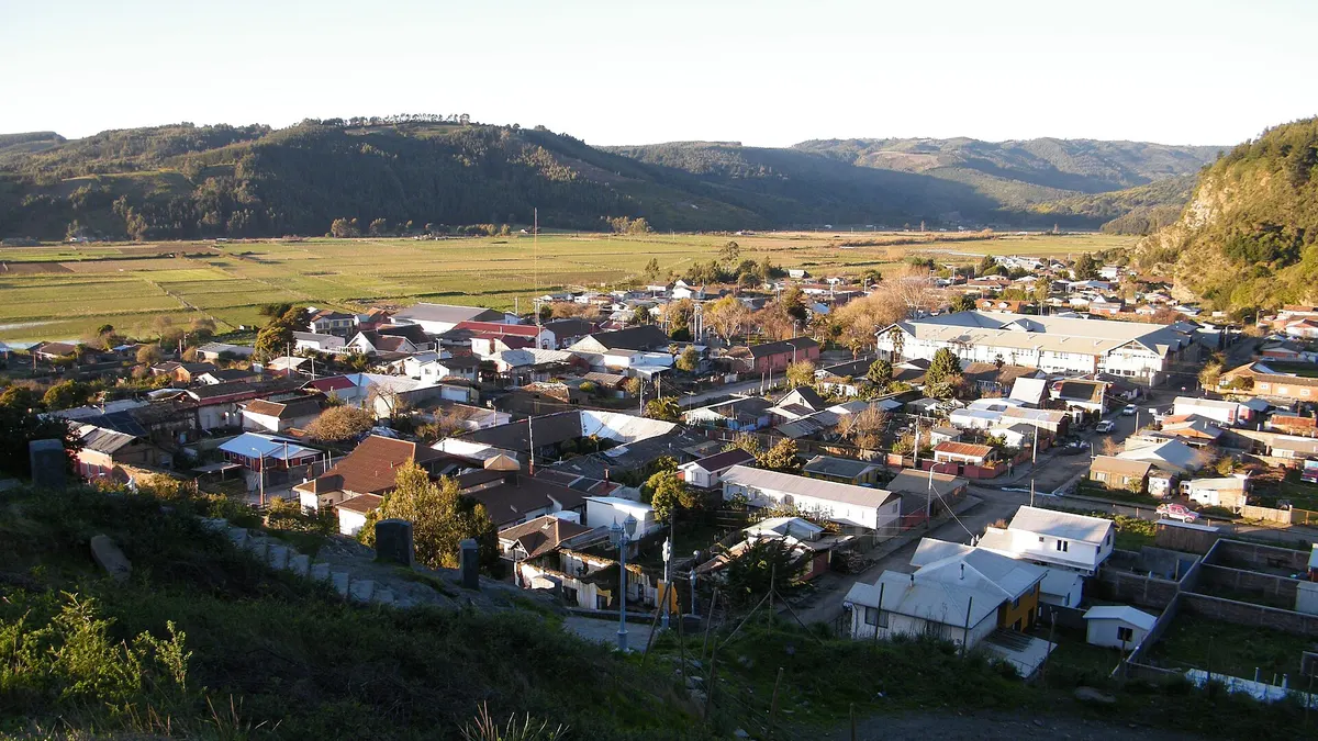
| Historic centre | Independencia street and the square | Adobe houses and slate walls, a Typical Zone since 2005 |
| Buchupureo | 13 km north | Beach famous for surfing and a river suitable for swimming |
| La Boca wetland and Pullay beach | North coast of the municipality | Birdwatching and quiet beaches |
| Playa Mure, Piedra Alta, Taucú wetland, Caleta Rinconada and Playa Colmuyao | Around the town | Coastal walks |
Sources: Wikipedia (historic centre), Wikipedia (Buchupureo) and the Ñuble coast itinerary on Chile.travel, by Sernatur, which recommends touring by car and staying on trails and viewpoints at wetlands and at the sea lion colony. The Typical Zone includes 22 houses and four urban spaces: Independencia street, the square, El Calvario hill and the old cemetery (Wikipedia).
- 1575FoundingAccording to tradition, chief Alejandro Piceros Carampangue founded the town on 11 January.
- 1863Port of BuchupureoIt opens to export wheat during the California gold rush.
- 1891The municipality is createdIn December, under the Autonomous Municipality law.
- 1992Nature SanctuarySea lion colony and Iglesia de Piedra, Supreme Decree 544 of 1 September.
- 2005Typical ZoneThe historic centre is declared a national monument in May.
- 2010Magnitude 8.8 earthquakeOn 27 February, with its epicentre off the Cobquecura coast.
For surfers, Buchupureo is the best-known beach in the municipality: according to Wikipedia, many consider it one of the best surf beaches in Chile. Compare it with other waves in our guide to surfing in Chile. Inland Itata is also a land of old-vine wines: see the wines of the dry interior.
Cobquecura weather: when to go
Cobquecura has a Mediterranean climate with winter rain and coastal influence (Wikipedia). There is no Chilean Meteorological Office station with historical data online in the town; the coastal reference is Carriel Sur, in Concepción, where the mean January temperature was 17.2 °C between 2016 and 2025, against 20.8 °C in Chillán. In other words, the coast is cooler than the valley in summer.
View the data as a table
| Concepción (coast, reference for Cobquecura) | Chillán (inland valley) | |
|---|---|---|
| Jan | 17.2 °C | 20.8 °C |
| Feb | 17.1 °C | 20.4 °C |
| Mar | 15.6 °C | 17.4 °C |
| Apr | 13.2 °C | 13.0 °C |
| May | 11.3 °C | 9.6 °C |
| Jun | 9.9 °C | 7.8 °C |
| Jul | 9.4 °C | 7.3 °C |
| Aug | 10.1 °C | 8.6 °C |
| Sep | 11.0 °C | 10.6 °C |
| Oct | 12.3 °C | 12.8 °C |
| Nov | 14.5 °C | 16.1 °C |
| Dec | 16.1 °C | 19.0 °C |
| Period | Mean temperature on the coast (Concepción) | What Cobquecura is like |
|---|---|---|
| December to February | 16.1 to 17.2 °C | High season; sea lion pups are born in summer |
| March and April | 13.2 to 15.6 °C | Fewer people and still mild days |
| May to August | 9.4 to 11.3 °C | Rain and rough seas |
| September to November | 11.0 to 14.5 °C | Spring; the Stone Church is covered in flowers |
Compiled by Viajando Chile with 2016-2025 averages from the DMC and sanctuary data from Wikipedia, which describes the spring blooms on the Iglesia de Piedra. For the daily forecast, check the DMC website before setting out. This summer is expected to be warmer than normal because of El Niño: see what to expect from summer 2026-2027.
How to get to Cobquecura
| From | How | Details |
|---|---|---|
| Santiago | Bus or train to Chillán | 403 km; bus from CLP 9,900 and about 5 hours, also EFE trains |
| Chillán | Car | Towards Quirihue and then Route N-50, the main access to the town |
| Chillán | Rural bus | From the rural bus terminal; check timetables before you travel |
| Concepción | Plane | Carriel Sur airport is about 130 km from Chillán |
Sources: Kupos for the Santiago-Chillán leg, checked on 9 November 2026, Wikipedia (Route N-50) and Chile.travel (distances to Chillán and the airport). As Sernatur recommends touring the coast by car, check the car rental requirements for foreigners in Chile. If you pass through the regional capital, see things to do in Chillán.
Frequently asked questions
Where is Cobquecura?
On the coast of the Ñuble Region, Itata province, between the municipalities of Pelluhue (Maule) to the north and Treguaco to the south.
Can you visit the Cobquecura sea lion colony?
The sea lions can be seen from the beach, about 250 metres away. Crossing to the islet at low tide is forbidden and fined, because it is a Nature Sanctuary.
What is the weather like in Cobquecura?
Mild and coastal: cool summers, with means of around 17 °C at the coastal reference station, and rainy winters. For the day of your trip, check the DMC forecast.
Where can you surf near Cobquecura?
At Buchupureo, 13 km north of the town, one of the best-known surf beaches in Chile.