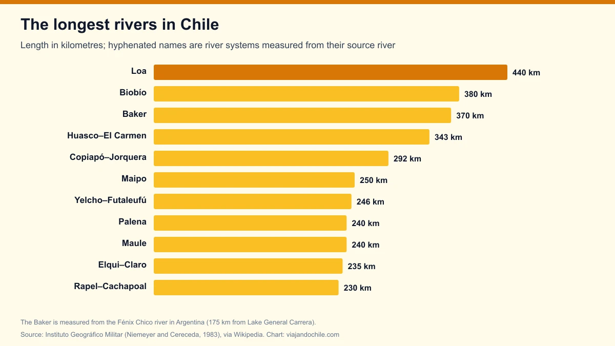
Chile's longest river is the Loa, at 440 km from its source at the foot of the Miño volcano, near Ollagüe, to its mouth on the Pacific, on the border between Tarapacá and Antofagasta. It is followed by the Biobío, at 380 km, and the Baker, at 370 km if measured from the Fénix Chico river in Argentina. The lengths come from the hydrography of Chile's Military Geographic Institute (Niemeyer and Cereceda, *Geografía de Chile*, 1983), compiled in Wikipedia's list of rivers of Chile.
*Updated on 10 November 2026.* A river's length depends on where its source is set: when a river is formed by the union of others, the table measures the whole system from its longest headwater (for example, Huasco–El Carmen). We point this out in each case.
View the data as a table
| Loa | 440 km |
| Biobío | 380 km |
| Baker | 370 km |
Ranking of the longest rivers in Chile
| Rank | River or river system | Length | Region | Basin |
|---|---|---|---|---|
| 1 | Loa | 440 km | Tarapacá and Antofagasta | 33,570 km² |
| 2 | Biobío | 380 km | Biobío and La Araucanía | 24,262 km² |
| 3 | Baker (from the Fénix Chico river) | 370 km | Aysén | 26,726 km² |
| 4 | Huasco–El Carmen system | 343 km | Atacama | 9,850 km² |
| 5 | Copiapó–Jorquera system | 292 km | Atacama | 18,800 km² |
| 6 | Maipo | 250 km | Metropolitan and Valparaíso | 15,380 km² |
| 7 | Yelcho–Lake Yelcho–Futaleufú system | 246 km | Los Lagos | 10,979 km² |
| 8 | Palena (Carrenleufú) | 240 km | Los Lagos and Aysén | 12,887 km² |
| 8 | Maule | 240 km | Maule | 20,300 km² |
| 10 | Elqui–Claro system | 235 km | Coquimbo | 9,657 km² (Elqui) |
| 11 | Rapel–Cachapoal system | 230 km | O'Higgins | 13,710 km² |
| 12 | Imperial–Cautín system | 229 km | La Araucanía | 12,054 km² |
| 13 | Mataquito–Lontué system | 221 km | Maule | 6,190 km² |
| 14 | Limarí–Hurtado system | 189 km | Coquimbo | 11,760 km² |
| 15 | Lluta–Caracarani system | 187 km | Arica y Parinacota | — |
| 16 | Itata | 180 km | Ñuble | 11,294 km² |
| 17 | Aconcagua–Juncal system | 177 km | Valparaíso | 7,200 km² |
| 18 | Salado | 175 km | Atacama | 7,575 km² |
| 19 | Camiña or Tana ravine | 163 km | Tarapacá | 2,790 km² |
| 20 | Cisnes | 160 km | Aysén | 5,302 km² |
| 20 | Choapa | 160 km | Coquimbo | 7,600 km² |
Source: Military Geographic Institute (Niemeyer and Cereceda, 1983) and other sources cited in Wikipedia's list of rivers of Chile; sorted by length by Viajando Chile. Only rivers that flow into the Pacific or its gulfs. Left out is the Lauca (225 km), which rises in Chile but ends in Lake Coipasa, in Bolivia.
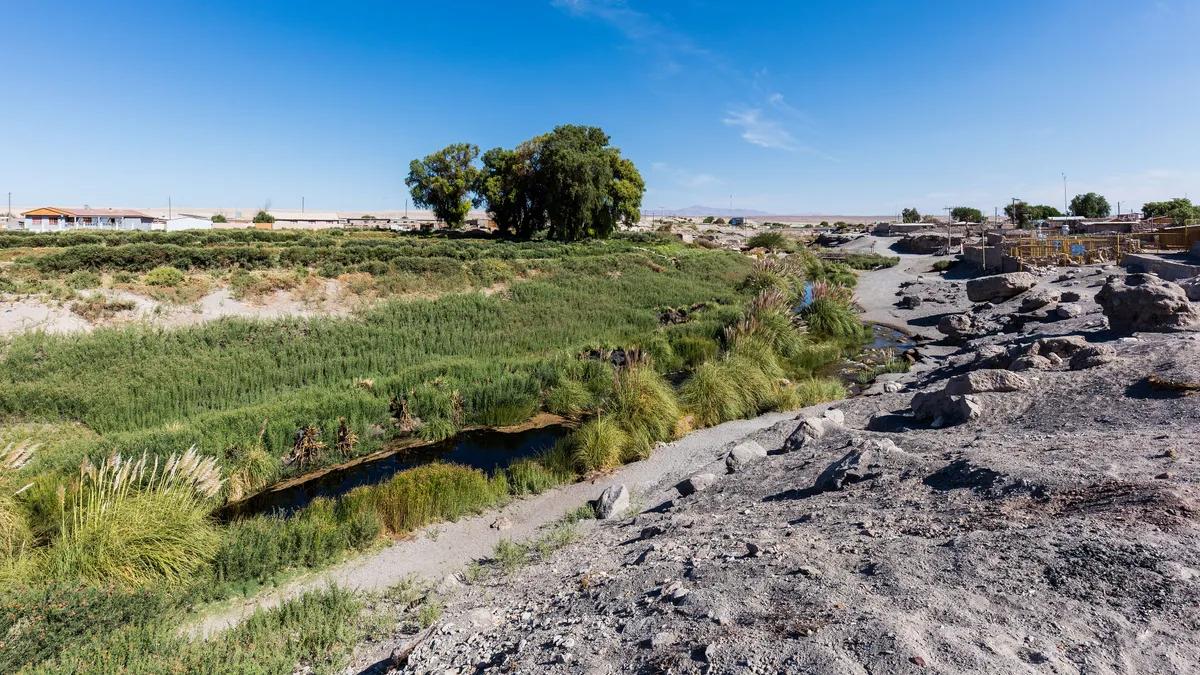
The Loa, Chile's longest river, crosses the desert
The Loa rises at more than 4,000 meters, runs through a canyon for over 150 km south to the oasis of Chiu Chiu, and ends in the Pacific. Its 33,570 km² basin is the largest in the country and the only one in the Antofagasta Region that reaches the sea. Despite its size it carries little water because of the desert's aridity, although it forms oases along its course (Wikipedia). To see it, the base is Calama or San Pedro de Atacama.
The longest rivers in Chile by basin area
Sorted by basin area, the Baker moves up to second place and the Maule into fourth. The Bueno river, only 130 km long, has the sixth-largest basin.
| Rank | River | Basin area |
|---|---|---|
| 1 | Loa | 33,570 km² |
| 2 | Baker | 26,726 km² |
| 3 | Biobío | 24,262 km² |
| 4 | Maule | 20,300 km² |
| 5 | Copiapó | 18,800 km² |
| 6 | Bueno | 17,210 km² |
| 7 | Maipo | 15,380 km² |
| 8 | Rapel | 13,710 km² |
| 9 | Palena | 12,887 km² |
| 10 | Imperial | 12,054 km² |
Source: list of rivers of Chile, Wikipedia, with Military Geographic Institute data. The Biobío has the third-largest basin in the country and is the widest river, averaging one kilometer across and up to two kilometers at its mouth (Wikipedia).
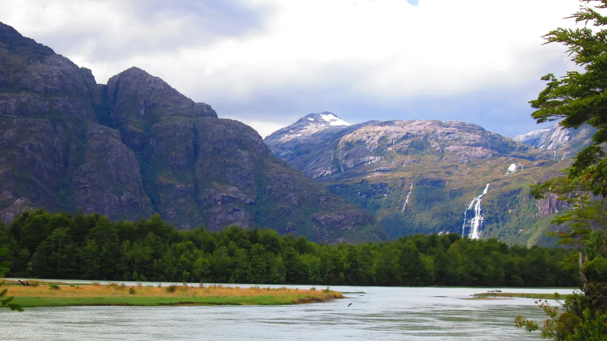
The Baker and the Biobío, the rivers with the greatest flow
The Baker flows out of Lake Bertrand, next to General Carrera. From that lake to the sea it measures only 175 km; the 370 km are counted from the Fénix Chico river in Argentina, a tributary of Lake General Carrera-Buenos Aires. Along with the Biobío it has the greatest flow in the country, fed by meltwater from the Northern Patagonian Ice Field, making it Chile's main hydroelectric potential (Wikipedia). It is reached via the Carretera Austral and flows into the sea near Caleta Tortel.
The longest river in each region of Chile
View the data as a table
| Tarapacá | 440 km · Loa |
| Antofagasta | 440 km · Loa |
| Biobío | 380 km · Biobío |
| La Araucanía | 380 km · Biobío |
| Aysén | 370 km · Baker |
| Atacama | 343 km · Huasco–El Carmen |
| Valparaíso | 250 km · Maipo |
| Metropolitana | 250 km · Maipo |
| Los Lagos | 246 km · Yelcho–Futaleufú |
| Maule | 240 km · Maule |
| Coquimbo | 235 km · Elqui–Claro |
| O'Higgins | 230 km · Rapel–Cachapoal |
| Arica y Parinacota | 187 km · Lluta–Caracarani |
| Ñuble | 180 km · Itata |
| Los Ríos | 140 km · Valdivia–Cruces |
| Region | Longest river in the table | Length |
|---|---|---|
| Arica y Parinacota | Lluta–Caracarani system | 187 km |
| Tarapacá and Antofagasta | Loa | 440 km |
| Atacama | Huasco–El Carmen system | 343 km |
| Coquimbo | Elqui–Claro system | 235 km |
| Valparaíso and Metropolitan | Maipo | 250 km |
| O'Higgins | Rapel–Cachapoal system | 230 km |
| Maule | Maule | 240 km |
| Ñuble | Itata | 180 km |
| Biobío and La Araucanía | Biobío | 380 km |
| Los Ríos | Valdivia–Cruces system | 140 km |
| Los Lagos | Yelcho–Futaleufú system | 246 km |
| Aysén | Baker | 370 km |
Source: list of rivers of Chile. Magallanes has no rivers in the table of courses over 100 km. Other national records, such as the largest lake or the highest volcano, are in Chile's natural records and Chile's largest lakes.
Frequently asked questions
What is the longest river in Chile?
The Loa, at 440 km, in the Tarapacá and Antofagasta regions. It also has the largest basin in the country, at 33,570 km².
What is the second-longest river in Chile?
The Biobío, at 380 km. The Baker measures 370 km counted from the Fénix Chico river in Argentina, and 175 km from Lake General Carrera.
Which river in Chile has the greatest flow?
The Baker and the Biobío have the largest flows in the country; the Baker, fed by the Northern Patagonian Ice Field, is the main hydroelectric potential.
Why are Chile's rivers short?
Because the country is narrow: most rivers flow from the Andes to the Pacific in an east-west direction.
How to cite this data
Viajando Chile (2026). *The longest rivers in Chile 2026: the Loa leads with 440 km, followed by the Biobío and the Baker*. With data from the Military Geographic Institute compiled in Wikipedia. Available at: https://viajandochile.com/en/news/longest-rivers-in-chile-ranking